

Minor road changes proposed for active travel in Bedworth
Just a quick thing...
I have chosen not to use adverts, pop-ups, mailing lists, or mandatory subscriptions, but it means there is an ongoing cost for me in researching and writing content, and generally advocating for active travel - time spent not working! If you can throw a few pounds my way to help out, your support is gratefully received! Thank you!

Update 16 December 2024: Despite objections, the installation of the new toucan crossing and short sections of shared use path was approved on Friday 13 December 2024.
Note: An update can be seen following the original article, after the receipt of further information. A copy of my own objection to this scheme is also available, which was sent to the Council on 08 October and acknowledged on 17 October. My objection, and one other, will be reported upon and considered by the Portfolio Holder for Transport and Planning on or around 13 December 2024.
Warwickshire Highways is proposing to make modifications at a junction in Bedworth which will facilitate part of a “Green Corridor” for active travel in the town. This has the specific aim of connecting to the popular Miners’ Welfare Park and the new Physical Activity Hub (aka leisure centre), to enable people to travel there without a car.
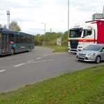
The changes – which impact the junction of High Street, Coventry Road, and Sergeant Simon Valentine Way (formerly the southern end of the Rye Piece Ringway but renamed last year) – consist of widening existing footpaths, upgrading paths to shared use for walking, wheeling, and cycling, and adding a new toucan crossing where currently only a pedestrian refuge island exists. The new shared use route will then enter the Miners’ Welfare Park at a new access point to the east of the existing pedestrian entrance.


The objective of creating a safe, pleasant active travel route to link with the new leisure centre is a good one. Local residents and even people from further afield, should be able to access local facilities without needing a car, particularly where that option will not be available to many. It’s also good to see something being developed by the County Council specifically for the benefit of people walking, wheeling, and cycling independent of any other road changes.
Sadly though, this is not a scheme without glaring problems. There are two issues – the use of shared space, and the cohesiveness of the broader cycle network.


Network cohesiveness
Taking the latter point first, when it comes to the Miners’ Welfare Park, the intention is to create a cycle route through to the new leisure facility and (potentially at least) down to the southern end of the park. This is under the remit of Nuneaton and Bedworth Borough Council and is likely to comprise of a 3m shared use path. More on shared space in a minute which I’m not a fan of, but at least we get a formal cycle route where currently there is none. The big problem is heading north from the proposed new crossing.

Bedworth has traditionally been hostile to cycling, something that is very obvious when reaching the pedestrianised area of the town centre just 60-odd metres away from the new shared use path, where cycling is banned. If the intention is to simply make a connection between the town centre boundary and the Physical Activity Hub, there’s no problem except very few cyclists will be using the new crossing; if the intention is as stated however, to enable local people to access the new leisure centre without a car, this is a massive issue. Unless I’ve missed it, there’s no intention to remove the no cycling restriction.
Without the broader network through the town centre and out to the north of the town, this new shared use facility with its toucan crossing cannot properly attract people to try cycling. So, what’s the benefit of it? Why spend the money making this tiny change but with limited appeal?
I have asked whether there are plans to change this restriction in conjunction with the planned road alteration scheme, but no answer was provided at the time of writing. The County Council has confirmed there are no immediate plans to change this despite it being included on the Local Cycling and Walking Infrastructure Plan.
Shared use space
The other issue of note is the decision to use shared use space which puts pedestrians and cyclists into potential conflict with each other. Of particular note is the narrowest point, the crossing itself which is further restricted by poles for traffic signals, but also – dangerously – as the path rounds the corner of a building which butts up against the pavement. This creates a clear risk of conflict and collision not only between pedestrians and cyclists, but cyclists and other cyclists, where visibility is unnecessarily hindered on the inside of the turn. Were riders forced to use the outside of the turn, perhaps on properly separated infrastructure, this risk would be reduced.
Shared use space is permitted in the latest cycle design guidance (LTN 1/20) but its use in an urban environment like this is very much discouraged, noting the risk of conflict and discomfort. As such, its use should be restricted to places where footfall and cycling numbers would be low or where there is no other alternative.
Well, at this location there likely is an alternative, and while numbers of pedestrians and cyclists might be low at present, if the aim is to increase them, then design should reflect higher numbers.
Some could argue that if shared use space is to be provided through the Miners’ Welfare Park then surely there’s no issue here. I would respond saying that 1) I haven’t seen final plans for the park which show the intention for cycling and this is therefore an assumption, 2) shared use space at 3m wide in the park is not suitable, especially where this is considered to be part of the main cycle route through Bedworth, but 3) it is better than what exists now – i.e., no formal route whatsoever – albeit far from perfect and with other very significant problems. I would rather see separated or at least clearly delineated, wider paths with the park being a secondary route. However, depending on design, it should be at least possible to have very good forward visibility to minimise the chance of actual conflict, something which the Warwickshire road scheme does not have.
What’s the alternative?
As always with these things, cost and political desire are two important areas that can hinder the viability of good quality schemes. But putting those to one side, it would seem there is an alternative option which could form part of a broader, cohesive north-south route. Given there are long-standing plans for schemes connecting between Nuneaton to the north and Coventry to the south, including an aspiration for a back street route that avoids cycling on the main roads through Bedworth, this should surely be a consideration.

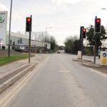
By upgrading Sergeant Simon Valentine Way to provide separated cycle provision between the roundabouts at either end (the junction with King Street at the north, and the junction with High Street and Coventry Road to the south), this would enable a connection to that back street plan to the north, linking into the new greenway through the Miners’ Welfare Park to the south. It would bypass the town centre and reduce (though not eliminate without some sort of provision on King Street and Bulkington Road) the gap between where the National Cycle Network route 52 ends, and the Park.
This section of road is only around 250m long, so it would hardly be an extensive scheme, and could work through carriageway reallocation where (for the most part) the road is wide with two general traffic lanes each around 3.5m wide, and central hatchings and ghost islands for turning appearing to waste a lot of space.

As for the town centre in this hypothetical scheme, it should still have its cycling ban relaxed to enable careful sharing on a pedestrian first basis where this improves access to the town as a destination, but the scheme would provide an alternative for people travelling through, rather than to, the area. The town centre will never be ideal as a through route where people will understandably want to ride faster than is reasonable in a shared use environment.
Again, I have asked whether other options for improving active travel connections to the park were considered before the actual proposed scheme was decided upon, and why alternatives were discounted. As yet, no answer has been received. An update has been received and is noted below.
Wrapping up
To repeat the point made at the start, it is good to see Warwickshire proposing a road scheme with the aim to improve active travel, even if it is a tiny adjustment. The objective is good and necessary, especially for a town with such poor cycling provision. But any scheme, no matter how big or small, needs to be considered as part of the bigger picture. How does it integrate with what already exists? Are people able to viably complete journeys that the scheme proposes to enable or is there anything else that would hinder those journeys? Does it create any new problems, even if it solves other ones, and can those be mitigated against? Is there an alternative that offers greater value in terms of the journeys it can capture and/or enable, even if the cost to build it is higher?
Asking questions of this scheme reveals fundamental problems. On its own, it doesn’t enable any journeys because they’re hindered by a cycling ban; it doesn’t make a fundamental difference to cycling safety and attractiveness because it doesn’t provide a realistic connection between the north and south of the town centre. Even without the cycling ban, town centre cycling is rightly limited to slow riding because it’s a pedestrian priority space.
Tinkering around the edges of our car-dominated highways is not enough to enable safe and attractive cycling. Warwickshire needs to provide meaningful schemes that can provide broader appeal if it truly wants to enable active travel and modal shift away from the car.
Warwickshire’s scheme is currently under consultation, and any objections or representations in support must be submitted by Friday 11 October 2024. The consultation is now closed.
Update 04 October 2024
Since publication yesterday, further information has been received following enquiries about the scheme.
- It has been confirmed that the “no cycling” restriction through Bedworth town centre will not be removed as part of this scheme. Warwickshire County Council has notes that its local cycling and walking infrastructure plan includes a proposal to “open up [the area] for cycling”, it is not currently working on these proposals.
- The Council’s road safety audit has not identified any issues with regard to providing shared use space or in terms of visibility rounding the corner.
- Warwickshire County Council was commissioned by Nuneaton and Bedworth Borough Council to design and provide this crossing, and that commission did not include the evaluation of other options. However, Warwickshire County Council “[did] not [consider it] feasible to deliver a segregated facility as part of this scheme due to a combination of factors including space constraints, the need to support a range of pedestrian movements, and the available budget.”
Update 09 October 2024
Yesterday, I sent in an objection to the scheme, as follows below. The consultation remains open until the end of Friday 11 October 2024.
Dear Warwickshire County Council,
With regard to the highways scheme, “Sergeant Simon Valentine Way (near High Street), Bedworth – Proposed Toucan Crossing & Cycletrack links”, I wish to make the following representations to ultimately object to the proposal in its current form.
To be clear, I do not object to the broader concept of improved active travel access to and through Bedworth Town Centre and the Miners’ Welfare Park; indeed I am strongly supportive of measures that would meaningfully improve and enable walking, wheeling, and cycling as a first choice for local transport across the town, borough, and county. This objection is solely on the specifics of the scheme as proposed.
While I note the potential for improvements for pedestrians, this objection focuses on the cycling side as that is specifically noted by the County Council as benefitting from the scheme. As will be clear, this is not actually the case. Even so, some points below also impact on the pedestrian experience.
The following points are not listed in any particular order of priority.
1. The scheme is not cohesive and provides no benefit to enabling active travel/cycling on its own.
There are no legal cycling options for notable travel north beyond the scheme, through Bedworth Town Centre where there is currently a ban on cycling. While Warwickshire has aspirations to open the pedestrianised area to cycling as detailed in its LCWIP, these proposals are not under active consideration and are not part of this scheme. Therefore the scheme as it stands cannot realise any benefits for cycling given there is no connectivity. The scheme is also not cohesive with broader cycling journeys that do not require the town centre connection (see also point 5, below).
For anyone who does happen to cycle on the short section of High Street that is open to cycling and wishes to connect with the Miners’ Welfare Park, they may consider it easier and potentially quicker to ignore the scheme and make the road connection to the Park as signed for the Bedworth Sports Club. In this event, if the scheme doesn’t necessarily capture cyclists that may be at the location, nor does it otherwise enable new journeys by cycle, there seems little benefit or value for money in providing it.
2. The scheme may not be compliant with the current cycling design guidance.
LTN 1/20 strongly discourages shared use provision in urban areas where it should only be used as a last resort, noting exceptions being where foot/cycle traffic is light and no other options are available. The issue of pedestrian-cycling conflict is noted in the guidance, where there is a perception that such routes can be unsafe and inaccessible. Other options would seem to be available at this location (see below) and if the objective is to increase active travel numbers, schemes should be designed with increased numbers in mind.
While the surface width of the proposed shared use route does not fall below 3m (that being the minimum width for situations where shared use space is employed), actual space appears to be reduced below 3m in its effective width at the north side of the toucan crossing due to the presence of traffic signal poles. The scheme therefore falls below minimum standards.
3. A risk of pedestrian-cyclist conflict and potential accessibility issues exist
Shared use provision puts both users into conflict which is a poor experience for all, but a particular risk for pedestrians with mobility issues or visual impairments. Such as risk is increased as the available width narrows. The corner rounding the building marked as “Building no 44” on the map is reasonably sharp and presents as a hindrance to forward visibility especially for those travelling on the inside of the turn (i.e., nearest to the building).
General conflict issues have not been identified in the Road Safety Audit despite these being clearly noted in the cycle design guidance, LTN 1/20. Also, on asking for an Equality Impact Assessment under the Equality Act 2010 which would evaluate any accessibility issues, none was provided and the assumption must therefore be that one has not been completed.
4. The scheme does not achieve the County Council’s objective to increase active travel with particular consideration to cycling
Warwickshire County Council has published in its Local Transport Plan, objectives to provide for, enable, and increase active travel in the county. This scheme as planned cannot achieve these objectives for the reasons as noted.
5. A better option exists that considers broader cycling journeys and a wider network
Putting to one side the matter of funding (where this may be a solvable problem through sources such as Active Travel England), a better option exists which would likely meet the requirements of the Borough Council in creating its Green Corridor to the new Physical Activity Hub whilst also becoming part of a broader cohesive network.
Such an option could be to provide separated cycling on Sergeant Simon Valentine Way between the roundabouts of King Street to the north and Coventry Road to the south. This would enable a town centre bypass using quiet streets connecting with King Street (west) and Edward Road, and would thus feed into the aspirational back street scheme that features as part of the County Council’s long-planned Nuneaton-Bedworth-Coventry cycle scheme. It would reduce the gap presented between the termination of National Cycle Network Route 52 at Tintern Way and the commencement of the Green Corridor through the Park. Subject to a short further cycling provision on King Street (east) to connect with Bedworth Station, that gap could be eliminated entirely.
There would appear to be sufficient width on this section of main road, where the narrowest point exists between St Francis RC Church and King Street roundabout – a limit of no less than 12 metres. This would still seem suitable to accommodate 2x 3m general carriageway lanes, 1x 3m cycleway, and 2x 1.5m footpaths. South of this location, space is more freely available still, perhaps to permit the inclusion of a buffer to the main carriageway for better separation.
While such a scheme would undoubtedly be more costly and disruptive in the short term, it would still be relatively small at about 0.5km (including connecting to the station; less if not) yet would provide much better value in a busy, motor-dominated area of town that has no cycle provision and as such is difficult to navigate, particularly with/for children and less confident riders. Provision solely around Sergeant Simon Valentine Way would enable safer cycling journeys between the north of the town and the new Physical Activity Hub. Linking to Bedworth Station would enable cycle journeys to/from the east of town via the National Cycle Network and other quiet streets, while also enabling multi-modal journeys. In both such cases (though one more than the other) Nuneaton and Bedworth Borough Council’s presumed objective of getting an active link to the Physical Activity Hub would be achieved.
This option also benefits in that the town centre itself need not be considered a through route. While cycling should still be permitted in this space, it should be on the basis that the town centre is a destination rather than a route to elsewhere, given that riding here will always rightly be on a slow, pedestrian priority basis.
In summary, the scheme as it stands does not provide value for money with regard to public funds (regardless of which pot funding comes from, whether WCC’s or NBBC’s), does not look at the bigger picture, and is flawed in its design failing to meet minimum standards. On its own, it will not benefit the Borough Council’s plans for a green corridor to enable active travel journeys to its new leisure facility, it will not achieve an increase in cycling, nor will it otherwise benefit cycling given the barrier presented by the legal ban on riding through the town centre. If this ban were lifted as part of, or very close to this scheme, there could be an argument that it may provide some value, but the County Council has confirmed that while there remains an aspiration to do this, it is not something being currently worked upon and thus there is no known timeframe for the ban to be removed.
While I understand the scheme is commissioned by Nuneaton and Bedworth Borough Council, the County Council should not simply agree given the existence of better options that align with published objectives to enable more active travel and can still provide the Green Corridor connection that the Borough Council desires. Instead, this should be taken as an opportunity to make a meaningful change to the roads environment around the town which is currently hostile to cycling.
As a result, this serves as an objection and the roads alteration as planned should not go ahead without broader consideration to the wider network and desired enablement of cycle journeys in the town and wider borough.
Please acknowledge receipt of this message to confirm it has been recorded and given proper consideration.
Regards,
Have you found this content interesting or useful? If so, and if you are able to, any contributions are greatly appreciated! Thank you! Oh, and do please share with others!


This is excellent coverage.
More strength to your elbow.
Unfortunately it seems you need something on all the Councillors with which to blackmail them !
Thanks Matt!