
Works set to begin on motor-centric junction redesign
Just a quick thing...
I have chosen not to use adverts, pop-ups, mailing lists, or mandatory subscriptions, but it means there is an ongoing cost for me in researching and writing content, and generally advocating for active travel - time spent not working! If you can throw a few pounds my way to help out, your support is gratefully received! Thank you!

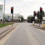
Two-and-a-half years after Warwickshire County Council put out a junction redesign for consultation, construction of the car-centric updated junction at Greenmoor Road, College Street, and Heath End Road in Nuneaton is set to begin in the Summer of 2024. The plans were approved last year with only minor changes to the original proposal, where now pedestrian crossings have been changed to toucan crossings and a pavement will be widened to provide a shared use space.
Details of the plan and my own consultation response, were described here back at the very end of 2021. The junction is an important and busy link to the A444 but also serves as a vital route to the hospital, a nearby school, BMX track, and other local destinations. Despite this, only minor consideration has been given to active travel “improvements” in the form of those minor adjustments to the original plan. Cyclists on road still won’t be afforded the bare minimum of a painted lane and advance stop line (ASL), let alone anything approaching meaningful and proper dedicated cycling infrastructure.
I assure you the comments you made were carefully considered, but needed to be balanced against the benefits the overall A444 corridor improvements will bring (of which the traffic order is a key part) such as addressing congestion issues on the A444 growth corridor, managing traffic flow, improving highway capacity, network resilience, journey time reliability, pedestrian/cyclist infrastructure, and realise planned employment and housing growth.
Decision letter, Warwickshire County Council, 29 May 2024
In its Equality Impact Assessment as well as its decision letter sent this month, the Council justifies its plans stating that the changes do improve active and sustainable travel provision and will enable modal shift, that doing nothing here is not an option due to forecast traffic growth, and that a benefit in health and wellbeing will be realised through reduced driver stress and frustration – which seems a very tenuous argument for stating that this scheme has physical and mental health benefits, none of which can be realised by driving.
In reality, is this likely to make a significant difference to modal shift? Putting pedestrians and cyclists into conflict on a shared use is never a good idea, and if either or both walking/wheeling and cycling were to increase significantly, it would become a very unattractive space, and an inaccessible and thus potentially discriminatory one too. It is therefore self-limiting in nature.
![Extract from the Equality Impact Assessment for the A444 corridor improvements. Under the heading "© Warwickshire County Council, Corporate Equalities & Diversity Team
WCC EqIA Forms A444.doc Page 4 of 11
Form A2 – Details of Plan/ Strategy/ Service/ Policy", "Stage 1 – Scoping and Defining", "© Warwickshire County Council, Corporate Equalities & Diversity Team
WCC EqIA Forms A444.doc Page 6 of 11
(3) What are the expected outcomes?": "Quantitative: 1,063 new jobs; Commercial Floorspace constructed 52 ha; Gross Value Added (GVA) of £52.35m; Significant reductions in PM (16:00 to 19:00) network journey times from 371 seconds (without
scheme) to 212 seconds (with scheme) in 2020/21. Qualitative: Improved journey time reliability for car borne commuters, bus passengers and freight deliveries; Health benefits associated with reduced driver stress and frustration [highlighted in the screenshot]; Increased business confidence due to reduced traffic congestion; Perceived safety improvements for pedestrians and cyclists and increased sustainable mode share [highlighted in screenshot]; Improved permeability/reduced community severance through provision of enhanced crossing
facilities."](https://fiets.uk/wp-content/uploads/2024/05/EqIA_A444_Corridor_GreenmoorRd_HeathEndRd_CollegeStreet-1024x364.jpeg)
Warwickshire argues that there is insufficient space to provide on-road painted cycle lanes which are required for ASLs, but this completely ignores the fact that *more* space is being given to driving with an additional general traffic lane being provided on Greenmoor Road. The concept of road space reallocation appears to be lost on the planners, especially for the north-south route on Greenmoor Road and College Street (Heath End Road is admittedly more challenging with significant space constraints).
Sadly this scheme is old and pre-dates the latest Local Transport Plan (LTP4), but it would be hard to see how it would align with the county council’s own objectives without significant changes.
But while it pre-dates LTP4, the design does not pre-date LTN 1/20, the national design guidance for cycling infrastructure issued by the Department for Transport which is meant to apply to all new and updated road schemes (i.e., this one included). In that, shared use space is permitted in certain circumstances, but it is highly discouraged a busy urban environment, where the clearly differing needs of people walking/wheeling and cycling are noted.
Shared use routes in streets with high pedestrian or cyclist flows should not be used. Instead, in these sorts of spaces distinct tracks for cyclists should be made, using sloping, pedestrian-friendly kerbs and/or different surfacing. Shared use routes away from streets may be appropriate in locations such as canal towpaths, paths through housing estates, parks and other green spaces, including in cities. Where cycle routes use such paths in built-up areas, you should try to separate them from pedestrians, perhaps with levels or a kerb.
LTN 1/20, Summary Principles
In urban areas, the conversion of a footway to shared use should be regarded as a last resort. Shared use facilities are generally not favoured by either pedestrians or cyclists, particularly when flows are high. It can create particular difficulties for visually impaired people. Actual conflict may be rare, but the interactions between people moving at different speeds can be perceived to be unsafe and inaccessible, particularly by vulnerable pedestrians. This adversely affects the comfort of both types of user, as well as directness for the cyclist.
LTN 1/20, Shared Use, 6.5.4
It is entirely evident that our seemingly car-addicted county council, its planners who create and sign-off on these schemes, and the councillors that ultimately support and approve them remain stuck in a motorbrain mindset, providing bare minimum token gestures to active travel so that they can technically say they’re providing infrastructure while in reality totally ignoring the need to provide far, far better car-free travel opportunities. They are failing to see that the problem of congestion is not to enable yet more of the same which will just induce yet more vehicles over time, but to bring an end to the car dependency that is generating so much local traffic in area of town that desparately needs safer, well-connected alternatives.
It is a fundamental failure of its duty to the town, borough, and wider county that this attitude persists.
As a final aside, there’s a strange irony in the fact that I received notification that the decision to proceed on this (and thus am writing this article) while in Rotterdam – a historically car-centric Dutch city which, while far from the best that the Netherlands has to offer, is still so enormously better for cycling than anything Warwickshire offers. We have such a long way to go, and we’re not even getting started.
Have you found this content interesting or useful? If so, and if you are able to, any contributions are greatly appreciated! Thank you! Oh, and do please share with others!